A Leading Weather
Software Solution Provider
Software Solution Provider

The right solution for providing direct access to pilots and airlines!
text text text
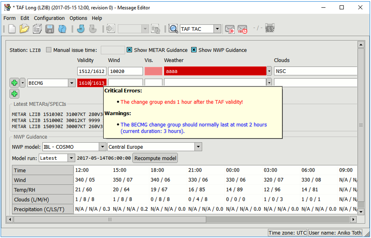
tuto cast pripravi Boris
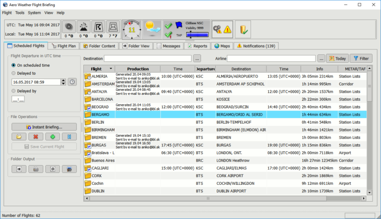
The PIB with the data relevant for the flight time and flight route will be instantly generated. It will include:
The PIB can be also produced automatically at scheduled times or before flight departure time. The result is a high-quality PDF, ideal for printing and electronic distribution. The PDF can be previewed, printed or automatically sent to specified e-mail addresses or FTP destinations.
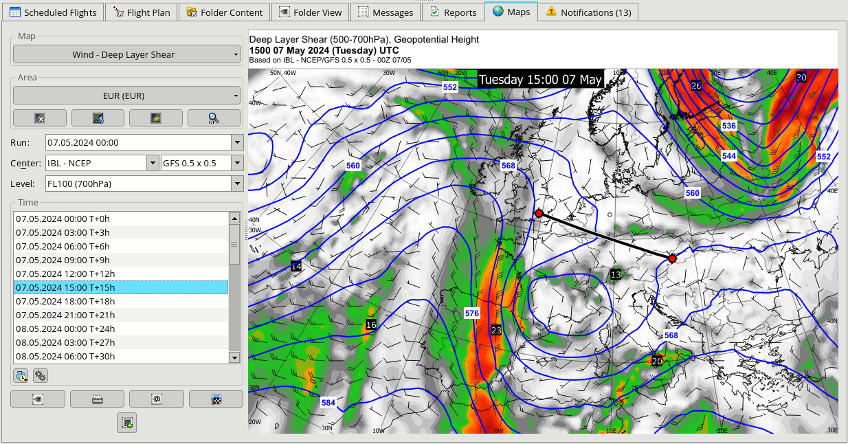
Large set of standard maps (SIGWX, WAFS forecast parameters, METAR, etc) which can be displayed for any selected area, validity time or level.
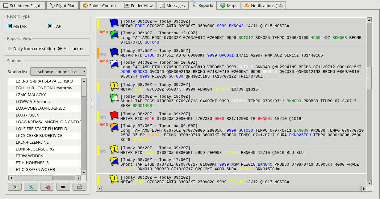
METAR and TAF lists can be displayed for a single station for the whole day, for a selected station or the current flight route.
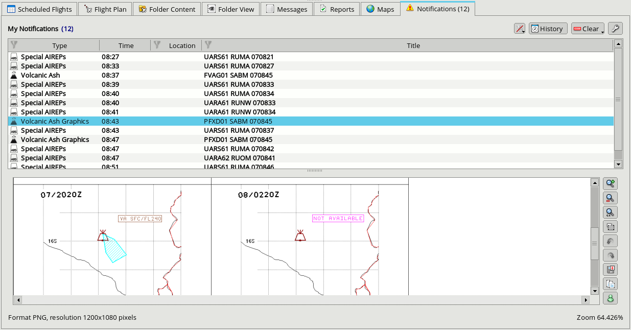
You can quickly view important warnings such as SIGMETs, volcanic ash advisories, aerodrome warnings because they are highlighted
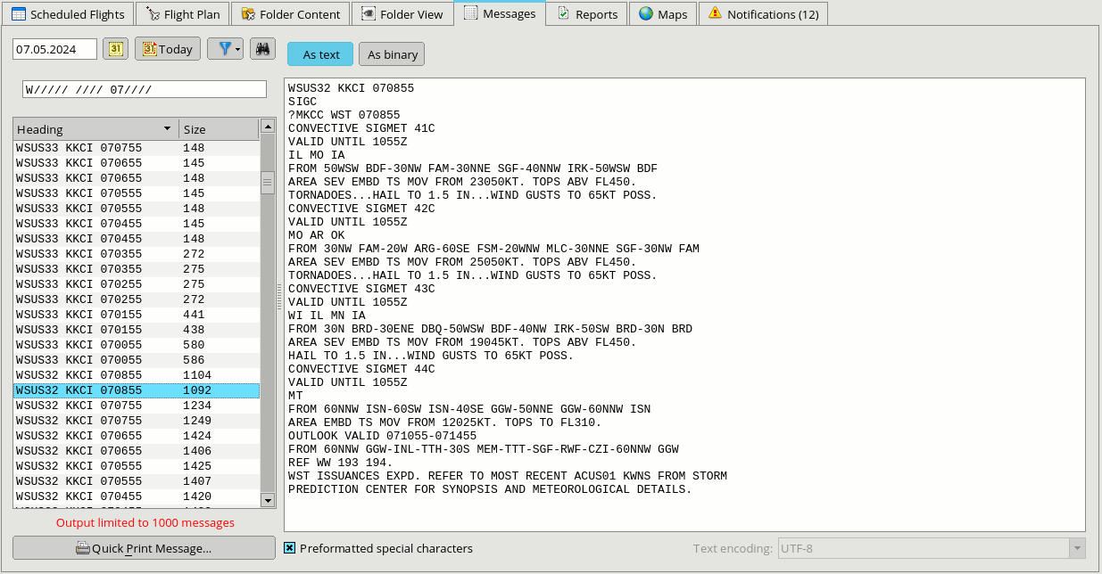
Every bulletin that is stored in the database can be easily found and displayed.
Aero Weather is a module-based software that can be easily extended by a large number of tools that take aviation forecasting to next level.
In addition to the standard WAFC/WIFS data, additional data sources such as satellite imagery, radar imagery, lightning detection network, etc. It is possible to create products displaying such data and these products can be added to the flight briefing to convey the weather situation in a clearer way.